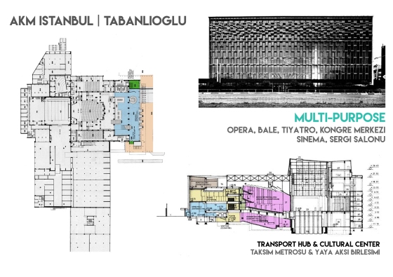
References & Diagram
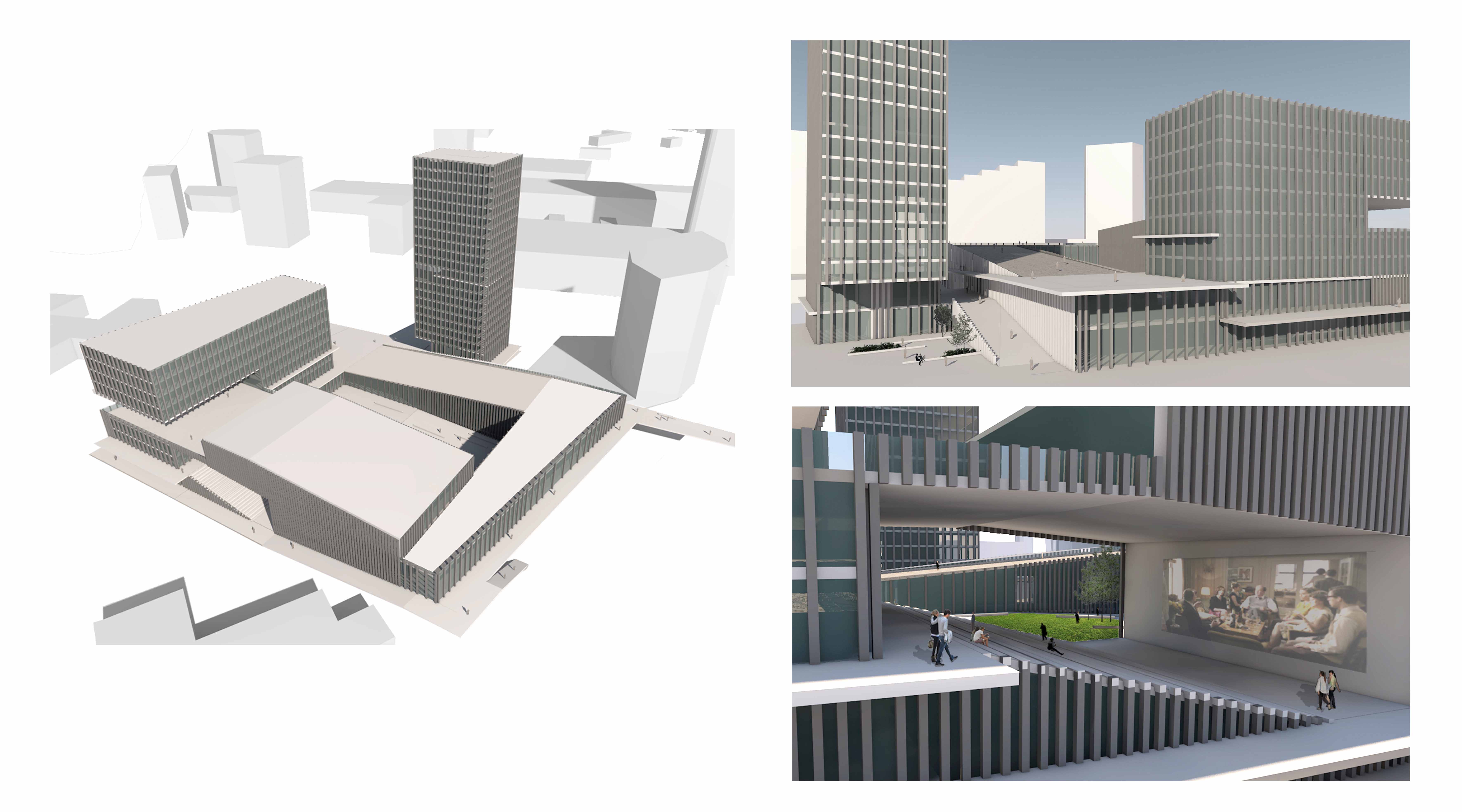
The Mass
Plans
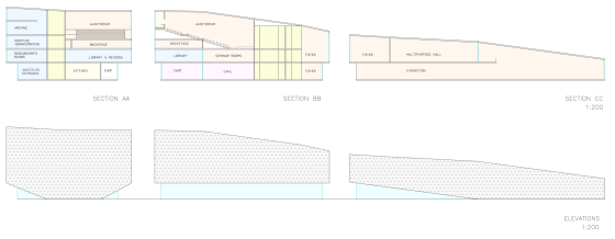
Sections & Elevations
References & Diagram
The Mass
Plans
Sections & Elevations
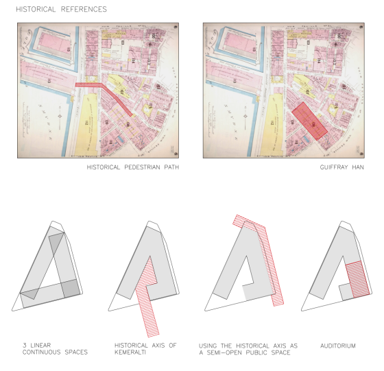
Because of the fact that the Kemeralti distict has a huge historical background, I decided to use and reappraise some of those historical references in my project. Through the process I analyzed a couple of historical maps, to determine the different conditions of the site and the pedestrian movement in different time periods.


I also made a research about the architectural element typologies used in the district. I reckon that numbers of examples of arasta and arcades can still be seen in the area. These studies helped me to find relevant references to use in my project.


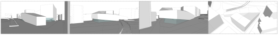
As a group of three, we were assigned different topics to focus on. My group has produced the section and elevation drawings of the site and the surroundings. We first took pictures of each facade during the site trip, then we united the photos on photoshop. Later on Autocad we produced the drawings, by scaling the photo according to a reference measurement.
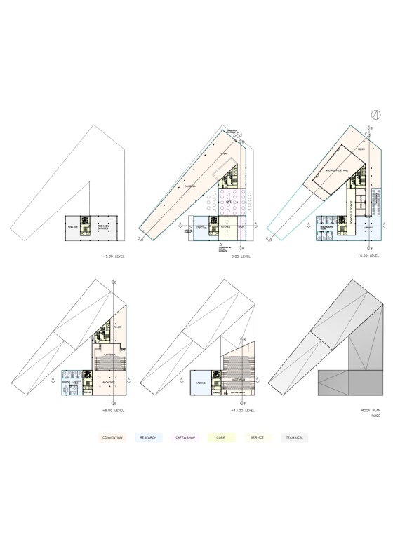
At the last semester we are designing a facility harboring Izmir Mediterranean Academy in a historical site in central Izmir. The site is located at the junction of very busy pedestrian and vehicular traffic, sea side of the historical district Kemeralti.
The aim of the academy is to represent Izmir as a city of culture and art. The final design should represent the vision of the academy by means of:
-an innovative architectural design
-an all-inclusive public building
-an ecologically conscious technology
-a reappraisal of the historical context
The given program for the facility includes of two main functions: convention (including exhibition hall, auditorium and multipurpose hall) and research facilities (for IMA’s archive, library and reading halls); along with the public functions such as shops and cafes.
After partially decided on the functions and the program, we are assigned to find precedents in similar scale.
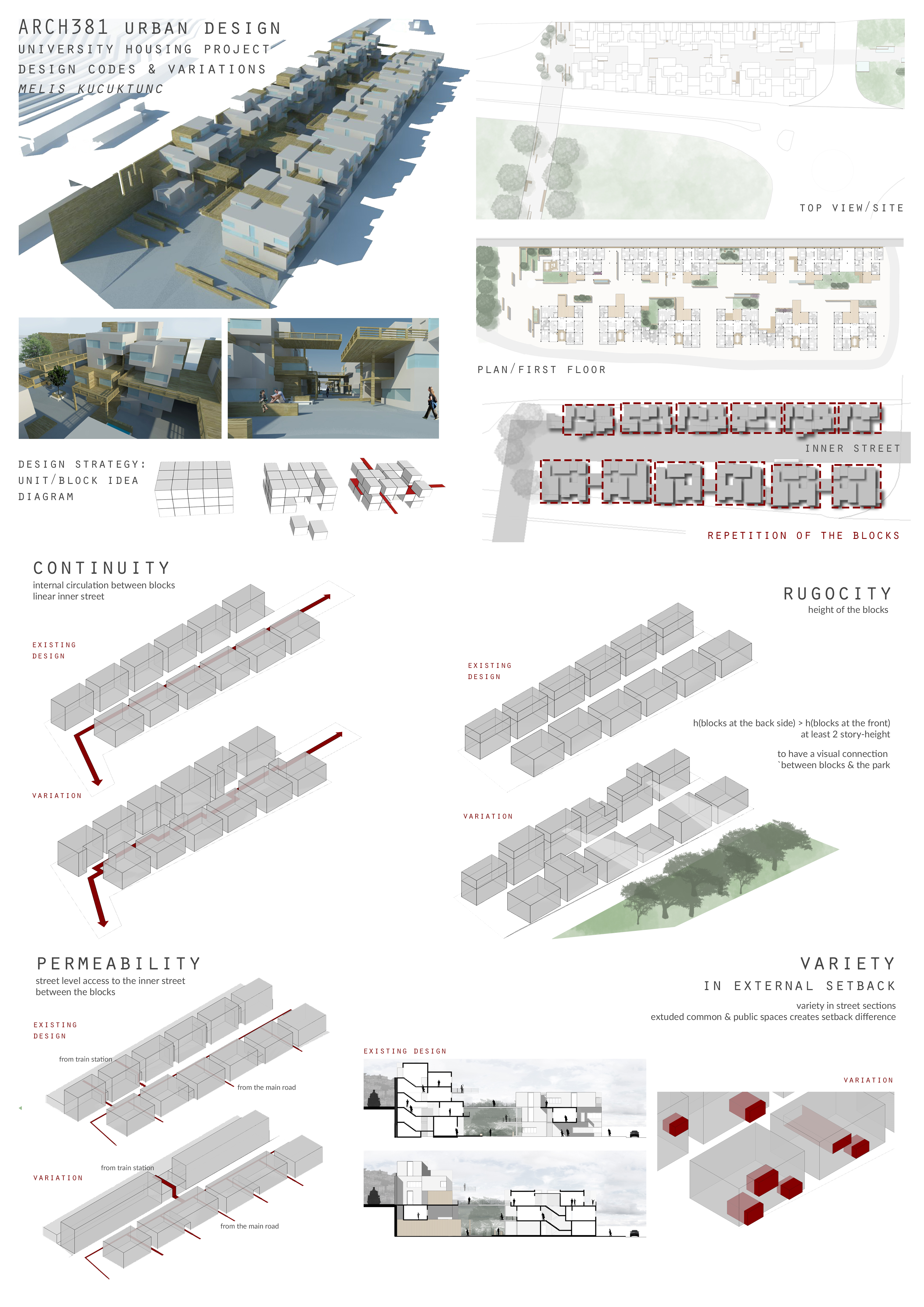
At the first half of the semester, we were asked to analyze Sogutozu district as a group project. My group and I were responsible for Mobility and Accessibility of the district.
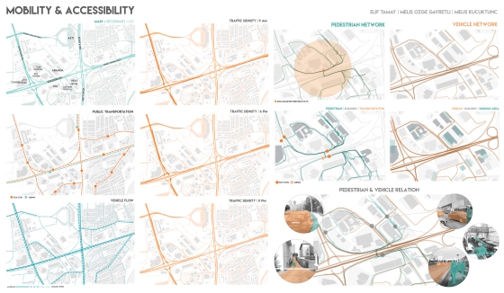
Based on the analysis we made, the major problem was lack of space for pedestrians. The whole area has extreme traffic density, being located at the intersection of Eskisehir and Konya Road, and Ankara’s public transportation network. The area therefore used by thousands of people everyday, both pedestrians and vehicles. So in our analysis we tried to focus on the relationship between these two.